|
|
Post by planner on Nov 16, 2016 16:02:07 GMT 10
Bridge opening to let a boat pass through. Shane Correct, Pyrmont Bridge opening to let through a work barge. Your turn to put up a photo Shane. |
|
|
|
Post by atefooterz on Nov 16, 2016 17:07:31 GMT 10
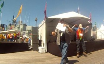
The fireworks barge entering into Cockle Bay. [Ï was taken to unread post so did not see it was already answered by Shane.] A decsription for folks who have the image host blocked. *What looks like a beer tent is a stage. This awkward comic relief vid still, from 2012, shows me getting an ultra wedgie from a mankini during a "swimwear during the ages" fashion show, i have just jumped from the stage & almost landed. ( i set up my go pro to capture an embarresing folly volunteer situation) I will not bore you with the 1900s -> present bikinis, worn by the far more glamourous models.  *One time it was sponsored by a whisky company & had freebies!  |
|
|
|
Post by Mustang on Nov 27, 2016 17:57:00 GMT 10
I think we need a clue Ate?
|
|
|
|
Post by atefooterz on Nov 28, 2016 0:44:16 GMT 10
I think we need a clue Ate? As this post jumped a page, i do not think Shane has realised or read the [post line] in my above post, that explains comments about the beer tent looking thing on the deck, a few posts before that.  |
|
|
|
Post by Mustang on Nov 28, 2016 17:06:34 GMT 10
I think we need a clue Ate? As this post jumped a page, i do not think Shane has realised or read the [post line] in my above post, that explains comments about the beer tent looking thing on the deck, a few posts before that.  Hi Ate, Why don't you post another image to start the ball rolling again? |
|
|
|
Post by atefooterz on Nov 28, 2016 21:12:30 GMT 10
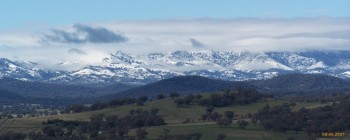
OK so a stolen image from the net: A NSW Lookout where back in the day and around the corner, the unrestricted speed sign and a straight road brought a smile, unless behind a weaving caravan that was tucked up behind a slow mo tractor!   |
|
|
|
Post by atefooterz on Dec 1, 2016 22:08:25 GMT 10
^ First clue is off the New England Highway way past burning mountain and way before heading into Tamworth
|
|
|
|
Post by whereswaldo on Dec 2, 2016 23:25:34 GMT 10
moonbi ranges?
|
|
|
|
Post by atefooterz on Dec 3, 2016 11:56:26 GMT 10
As you can see them in the distance so you need to go back South East, a ways, to the lookout, great start. |
|
|
|
Post by Mustang on Dec 6, 2016 16:37:40 GMT 10
As you can see them in the distance so you need to go back South East, a ways, to the lookout, great start. Hanging Rock?  ??  |
|
|
|
Post by atefooterz on Dec 6, 2016 22:51:23 GMT 10
As you can see them in the distance so you need to go back South East, a ways, to the lookout, great start. Hanging Rock?  ??  Mirandaaaaaah!!!!!!!! who da thunk it?  |
|
|
|
Post by atefooterz on Jan 22, 2017 1:50:16 GMT 10
|
|
|
|
Post by atefooterz on Apr 7, 2017 10:20:43 GMT 10
OK so to inspire anyone who wishes to continue this thread i will solve the Sydney CBD pics: 1: SCC Building(was Elcom i think at pic that time i think) looking North Eastish at the crest of the Regency Park Hyatt. Trivia was the Bogon moth plague in the plant room = smell & urgghh. 2: Centrepoint Tower, i have others from that day showing the Sydney 2000 games statues... posted below 3&4: SCC rooftop again,looking NW & West. Trivia: How much phone reception on top of Centrepoint? None! We soon found out that any rooftop above Australia Square height had very sketchy reception, even on some buildings like Governor Phillip Tower (of Matrix movie fame) when you are looking at the cell antennas no signal, as it radiaties down to cover buildings & street & the MLC building ones, put into help workers up high were hidden by other buildings. I wonder a decade later if it has changed?    OK now we need something new  |
|
|
|
Post by planner on Apr 7, 2017 12:31:15 GMT 10
OK so to inspire anyone who wishes to continue this thread i will solve the Sydney CBD pics: OK now we need something new  I'm still keen to play the game Ate, but I cant see any of your pics (stoopid work censorship). |
|
|
|
Post by atefooterz on Apr 7, 2017 15:58:48 GMT 10
OK so to inspire anyone who wishes to continue this thread i will solve the Sydney CBD pics: OK now we need something new  I'm still keen to play the game Ate, but I cant see any of your pics (stoopid work censorship). An easy fix is it is your turn as i solved the above! The Java scripting & cookies on photobucket jam both my computers & trigger anti-ware. But touch wood being unhacked-trojaned since 2002, i am not changing how i set up my gear lolz! The google? Picasa or whatevs i do not wish to spam with random pics as they will show up on google image search & enough already does.  |
|
|
|
Post by Mustang on Apr 8, 2017 7:08:35 GMT 10
I'm sure a number of members would have a look in, but we need images of places not communication towers???LOL
|
|
|
|
Post by atefooterz on Apr 8, 2017 7:24:19 GMT 10
I'm sure a number of members would have a look in, but we need images of places not communication towers???LOL The rooftops of Sydneys CBD landmark buildings are not communication towers!  This one is though...  youtu.be/JwSQEimQehg youtu.be/JwSQEimQehg |
|
|
|
Post by kiwijim on Apr 10, 2017 13:41:15 GMT 10
I'm sure a number of members would have a look in, but we need images of places not communication towers???LOL The rooftops of Sydneys CBD landmark buildings are not communication towers!  This one is though...  youtu.be/JwSQEimQehg youtu.be/JwSQEimQehgI thought the heading on this tread was "Where's this" !!! how are we supposed to see where we are ,from a seat of a 4x4 bouncing through the Bush  ?? K.J. |
|
|
|
Post by atefooterz on Apr 10, 2017 21:01:27 GMT 10
The rooftops of Sydneys CBD landmark buildings are not communication towers!  This one is though...  youtu.be/JwSQEimQehg youtu.be/JwSQEimQehgI thought the heading on this tread was "Where's this" !!! how are we supposed to see where we are ,from a seat of a 4x4 bouncing through the Bush  ?? K.J. Maybe some hijinks while we wait for planner or anyone else interested TO POST A PHOTO, will stop me spamming?     www.youtube.com/watch?v=fVn_ENYcL0E www.youtube.com/watch?v=fVn_ENYcL0E (If the previous vid was not so foggy the Lake Maquarie & Ocean views, plus sprawl of Newcastle, would give a hint to the hills adacent to Sugarloaf Mountain NSW. ( that track is the access around the area)
|
|
|
|
Post by planner on Apr 19, 2017 15:52:31 GMT 10
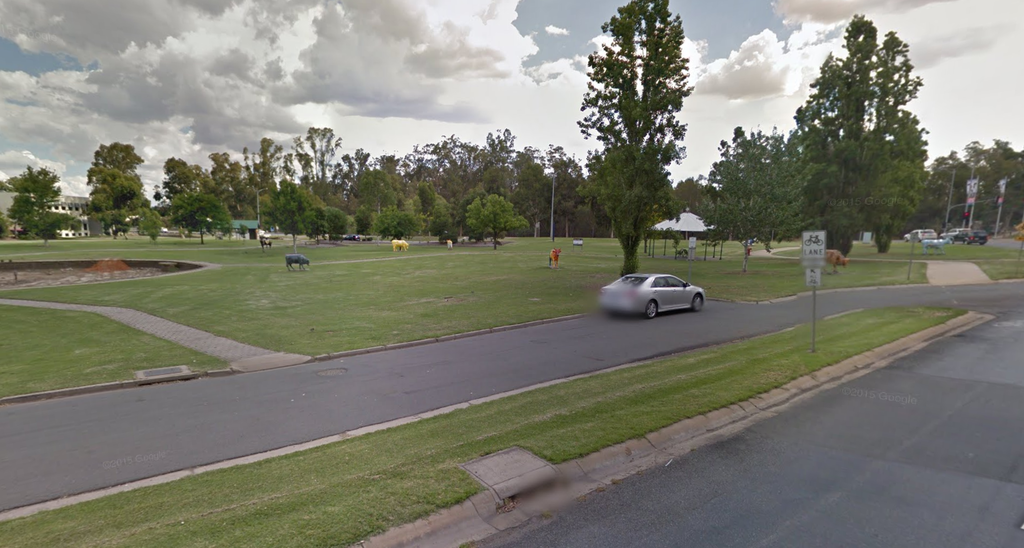
An easy fix is it is your turn as i solved the above! Here we go, I stole this from streetview, but it's a site I visit regularly.  Shouldn't be too difficult to solve. Planner |
|
|
|
Post by atefooterz on Apr 20, 2017 3:02:36 GMT 10
Stake Hill, Riverland Drive entrance?
|
|
|
|
Post by planner on Apr 20, 2017 8:51:13 GMT 10
Stake Hill, Riverland Drive entrance? Nope, missed it by quite a long way (I had to google maps Stake Hill) |
|
|
|
Post by snoops on Apr 20, 2017 16:54:16 GMT 10
Monash Park Shepparton. The park just on the way out to Mooroopna just before the causeway. Looking South West from Fryers Street.  |
|
|
|
Post by planner on Apr 21, 2017 8:44:59 GMT 10
Monash Park Shepparton. The park just on the way out to Mooroopna just before the causeway. Looking South West from Fryers Street.  Not quite Snoops, looking more South/South West  Your turn to put up a pic. |
|
|
|
Post by snoops on Apr 21, 2017 13:25:32 GMT 10
I was almost going to put SSW but thought that may be a bit much.  . I have lunch there quite a bit when in town. I'll dig up a pic from my recent trip. |
|